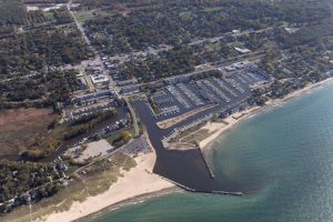
Home | Print | Log In |
Search: Go


Michael D. Mitchell
City Manager/ Harbormaster
224 W. Buffalo St.
New Buffalo, MI 49117

Telephone:  269-469-1500
Facsimile:  269-469-7917
harbormaster@city....org


Spring through Fall
City Beach/ Boat Launch:
269-469-1522
City Transient Marina:
269-469-6887
Marina Reservations:
800-447-2757


New Buffalo Harbor


FEDERAL CHANNEL OPEN – UPDATE

June 15, 2011 — The U.S. Army Corps of Engineers has issued a new soundings map taken this month of New Buffalo’s Federal Channel.

At the end of April this year, the Federal Channel was dredged by the City of New Buffalo, thanks to a grant from The Pokagon Fund.  Please view this soundings map showing the before dredging conditions of the Federal Channel (detailed in the first six pages) and after dredging conditions (pages 7-12).

Ordinarily, Congress funds dredging the Federal Channel.  However, this year (two years ago) Congress failed to do so.  Also, Congressional leaders are determined to have no earmark spending in the near-term.   The City is working with Representative Upton and Senators Levin and Stabenow on establishing protected, regular funding for dredging.

JULY 7 HARBOR COMMISSION MEETING

Keeping the Federal Channel navigable is a priority project of the New Buffalo City Council.  Therefore, the City is working on creating a sustainable dredging fund.  Everyone with an interest in keeping New Buffalo Harbor navigable is invited to attend the next Harbor Commission meeting, Thursday, July 7, at 6:30 PM, at City Hall, 224 W Buffalo St, New Buffalo, MI.  Different funding options will be explored.  The existing ordinance which created the City’s Emergency Harbor Dredging Fund will also be discussed.


HARBOR CHANNEL CONDITIONS – MARCH 3, 2011

On March 3, 2011, the United States Army Corps of Engineers took soundings of the Federal Navigation Channel.  Please see the online conditions map.  Please note that the information depicted on this map represents the results of surveys made on March 3, 2011, and can only be considered as indicating the general conditions present at that time.  Conditions can and do change quite a bit.  Please use caution when navigating in the Federal Channel.  All soundings are referenced to IGLD 1985 for Lake Michigan, elevation 577.5 ft. above mean sea level at Rimouski, Quebec.  A hydralic corrector of 0.32 ft. was added.

On March 15, 2011, the City Council, during their Regular Meeting, voted to move forward with dredging by authorizing Wightman and Associates to prepare plans, specifications, and bids, as well as contract preparation, administration and inspection for dredging.  The City will advertise for bids, and then a contractor will be selected to perform the dredging work.  The City has a goal of having this dredging work completed by May 1, 2011.


ABOUT NEW BUFFALO HARBOR

New Buffalo Harbor has more than 950 boat slips:  919 marina and condo association slips, 32 transient-public slips, several under construction for Dunescape on the Peninsula, and several up-river private slips.

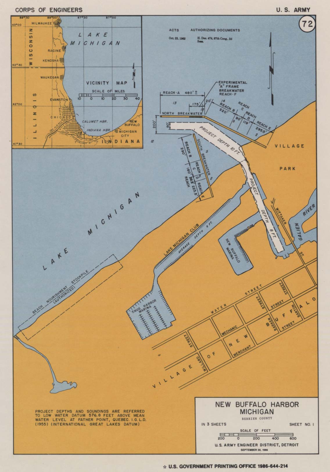
The U.S. Army Corps of Engineers' Fact Sheet, Dredging Information, Project Map, and most recent Condition of Channel Survey as a PDF are available on their New Buffalo Harbor Project Overview webpage.

New Buffalo Harbor – Facing south (image courtesy USACOE).

New Buffalo Harbor


Please place your mouse over each symbol to see its label, or use the key below:


The US Army Corps of Engineers created this image of our harbor using a 2005 aerial covered with a 1857 survey to show how much has changed.  Click here for a large version (WARNING - very large file size; it may take your browser awhile to fully load this pdf).

pas_new_buffalo_cover.jpg

This page last updated on 12/8/2011.
New Buffalo City Hall | 224 W Buffalo St | New Buffalo, MI 49117 | Telephone: 269-469-1500 | Facsimile: 269-469-7917 | Webmail